Do you love the idea of walking from your backyard to your boat, then cruising straight to the Intracoastal? In The Landings, that lifestyle comes down to one thing: whether your boat can safely clear the bridges and navigate the canals from your dock to open water. If you are buying, the wrong clearance can turn a dream dock into a pretty view. If you are selling, clear information about access helps you attract the right buyer and avoid surprises. In this guide, you will learn how bridge clearances work, what to check about canal depths, who to call for current rules, and how to align a Landings property with your boating needs. Let’s dive in.
Why bridge clearance matters in The Landings
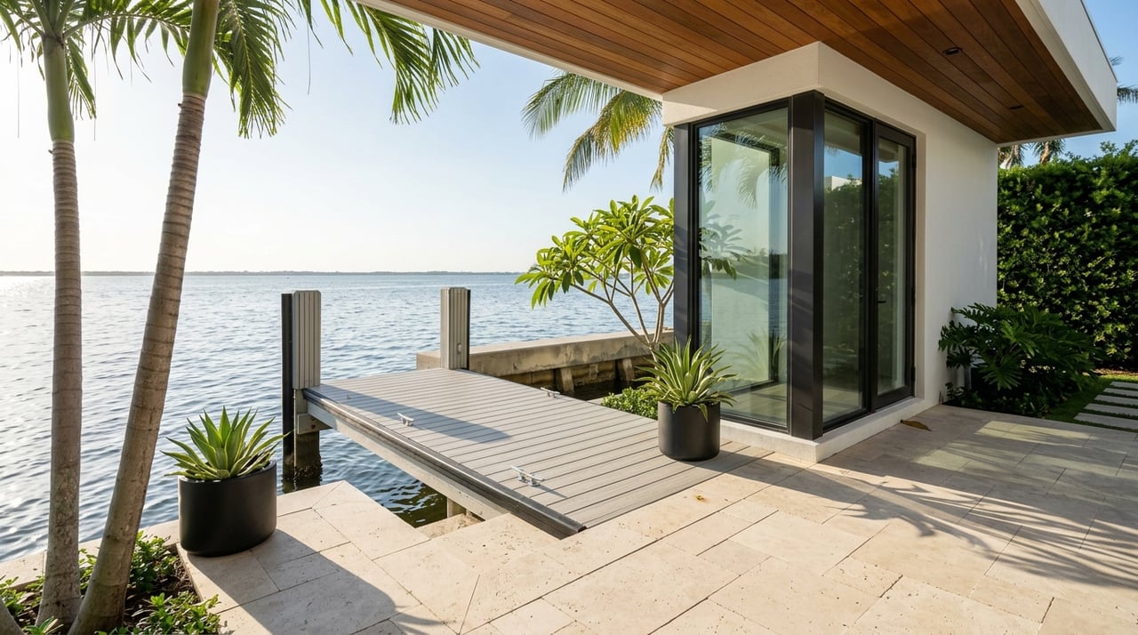
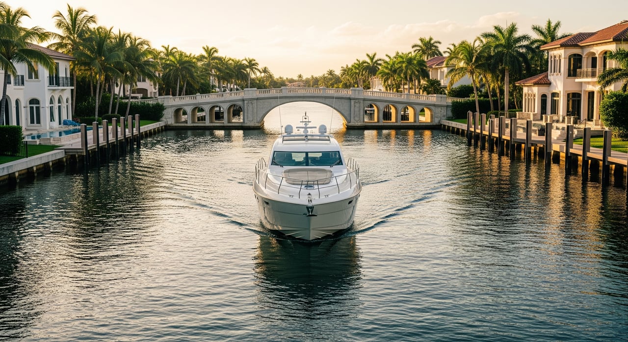
The Landings is a waterfront neighborhood with private canals that connect to city waterways, the New River, and the Intracoastal Waterway. Whether your vessel can make that trip depends on two fundamentals: the height of the bridges you must pass under and the depth and width of the canals you must travel through. A mismatch between a boat’s air draft and a bridge’s vertical clearance can limit or block your route entirely.
For buyers, this is a key part of due diligence. For sellers, accurate disclosure about bridge clearances and canal conditions sets realistic expectations. In both cases, you benefit from understanding the route from a specific dock to the Intracoastal and what it can handle.
How boats reach open water from The Landings
Homes in The Landings sit on canals that connect out to larger city waterways, then to the New River and the Intracoastal Waterway. Each property may follow a slightly different path depending on its canal frontage. Along the way, you can encounter fixed bridges and movable bridges that influence what size vessel can routinely pass.
Because routes can vary, you should map the exact path from a given dock and identify every bridge and potential pinch point along the way. The safest approach is to pair local knowledge with authoritative navigational references and to verify any temporary changes before you go.
Bridge types, clearance, and tides
Bridges fall into two categories that matter for boaters: fixed bridges and movable bridges.
- Fixed bridges have a permanent vertical clearance. If your boat’s air draft is higher than that number, you cannot pass beneath.
- Movable bridges can open for taller vessels. Operations are governed by federal drawbridge regulations and local bridge tenders.
Tides also affect your options. Even in southeast Florida, where the tidal range is modest, higher water levels can reduce clearance enough to turn a tight fit into a no-go.
What vertical clearance really means
Vertical clearance is the distance from the water’s surface to the lowest part of the bridge structure. It is usually reported relative to a tidal datum such as Mean High Water or Mean Lower Low Water. When you compare your boat’s height to a bridge clearance, make sure you know which datum the number uses and adjust for the tide at the time of transit.
Movable bridge openings and rules
Movable bridges operate under federal rules in Title 33, Code of Federal Regulations, Part 117. Some open on signal, while others follow schedules or limit openings at certain times. Temporary restrictions can occur for construction, maintenance, or events. The most reliable way to confirm current operations is to check authoritative notices and contact the local bridge operator before you plan your trip.
Canal depth, width, and maintenance
Clearance is only half the story. You also need enough water under your keel and enough room to maneuver.
- Depth: Shoaling can change depths in canal sections, especially after storms. Verify the depth along your route and compare it to your vessel’s draft with a safety margin.
- Width and turning basins: Larger boats need room to turn and line up for bridges. Identify where you will turn and how much room you have at your dock and along the route.
- Maintenance: Private canals may be maintained by property owners, a homeowners association, a special district, or the county. Dredging plans and schedules matter if your vessel needs more depth.
Step-by-step: Will your boat fit?
Use this five-part process to confirm whether your boat can pass from a specific dock in The Landings to open water.
- Measure your boat’s air draft.
- Identify the highest fixed point above the waterline. Include mast, radar arch, bimini frame, light poles, and mounted antennas. If any items fold, confirm the folded height.
- Gather published bridge clearances and confirm the datum.
- Use official charts and bridge listings as a starting point, and note whether each clearance is listed at Mean High Water or another datum. Keep a log of every crossing on your planned route.
- Check tide predictions for your transit window.
- Compare the predicted tide height to the clearance datum. If the clearance is published at Mean High Water and you plan to pass at lower tide, you may gain extra clearance. Always plan for a safety buffer.
- Verify canal depths against your boat’s draft.
- Account for tide, recent weather, and any shoaling. Talk with local operators and long-time residents for practical insight, then confirm with authoritative sources.
- Build in a safety margin.
- Do not plan a transit that assumes zero clearance. Leave room for wave action, wake, measurement error, and changes in water level from rain or storm surge.
Who to contact for up-to-date answers
When you need authoritative information, go to the sources that set and publish the rules:
- U.S. Coast Guard Sector Miami for Local Notices to Mariners and any enforcement or emergency updates.
- NOAA Office of Coast Survey for nautical charts, corrections, and bridge data.
- City of Fort Lauderdale and Broward County bridge operations or traffic engineering for local bridge schedules and contacts.
- Florida Department of Transportation for state-owned bridge information.
- South Florida Water Management District for any relevant water-control structures.
- Local marinas, yacht clubs, and long-time residents for on-the-water context about shoaling and practical constraints.
Buying in The Landings: a due diligence checklist
Use this checklist to align a property with your boating plans before you write an offer.
- Map your exact route from dock to the Intracoastal. List every bridge and canal segment.
- Measure your vessel’s air draft and draft, then compare to published clearances and depths.
- Confirm the tidal datum for each bridge’s clearance, and check tide predictions for your typical transit times.
- Ask about canal dredging history, schedules, and funding responsibilities. Determine who pays and how often dredging occurs.
- Evaluate maneuvering room. Identify turning basins and pinch points.
- Inspect seawalls and docks. Permits may be required for repairs or replacements, and structural condition can affect safe docking.
- Review USCG Local Notices to Mariners for temporary changes such as construction, repairs, or limited openings.
- Speak with local marinas or yacht clubs for practical insight on shoaling and bridge-tender practices.
- Verify HOA or neighborhood rules about dock size, lifts, and number of vessels.
Selling in The Landings: set clear expectations
If you are listing a waterfront property, buyers will ask about boat access. Be ready with straightforward documentation. It builds trust and helps you reach the right audience.
- Provide a simple route map from the dock to the Intracoastal with a list of bridges encountered.
- Note published bridge clearances with the tidal datum and remind buyers to check current tides.
- Share any canal maintenance information you have, including dredging records if available.
- Disclose known limitations like low fixed crossings near the home or tight turning areas.
- Offer recent permits or engineering reports for docks and seawalls, if applicable.
How low bridges can influence value
The presence of a low fixed bridge can limit the pool of buyers who need tall-masted sailboats or high superstructures on sportfishing yachts. For buyers with smaller powerboats or those who prioritize waterfront lifestyle over offshore runs, the impact may be minimal. Local comparable sales and current buyer profiles will show how the market values a particular canal and route. The key is to match the property’s navigational reality to the likely buyer.
Permits, repairs, and homeowner responsibilities
Waterfront improvements often require permits from multiple agencies. Dock building or replacement and seawall repairs usually involve Broward County and possibly the City of Fort Lauderdale. Dredging or shoreline reinforcement can require environmental permits from the Florida Department of Environmental Protection and, for certain waters, the U.S. Army Corps of Engineers. When in doubt, confirm before you plan work. Clear permitting protects you and your neighbors and helps maintain navigability over time.
Common pitfalls to avoid
- Assuming a clearance number uses the tide you expect. Always check the datum and current prediction.
- Relying on past experience without verifying current conditions. Temporary restrictions appear in Local Notices to Mariners.
- Planning transits with zero margin. Leave room for wake, rain, and measurement error.
- Overlooking vessel changes. Added equipment like radar domes or outriggers can increase air draft.
- Ignoring canal width and turning space. Even with enough depth and clearance, tight geometry can complicate passage.
A local partner for a smooth process
Choosing a waterfront home in The Landings is about more than square footage. It is about how you will use the water every day. With the right guidance, you can quickly confirm the bridges, tides, and canal conditions that matter for your boat and your lifestyle. If you are selling, presenting that information clearly helps you connect with the right buyers and protect your timeline.
If you want tailored, property-specific guidance, schedule a private consultation with Heather Lefka. You will get neighborhood-level insight, access to trusted local resources, and a concierge process from first tour to close.
FAQs
How do bridge clearances affect boating from The Landings?
- Your boat’s air draft must be lower than each bridge’s vertical clearance for fixed crossings, and you must follow operating rules for movable bridges to reach the Intracoastal.
Do Fort Lauderdale drawbridges open on demand for Landings residents?
- Some open on signal, while others follow schedules or time restrictions under federal regulations; always confirm current rules and any temporary changes before transiting.
Where can I find current bridge clearance numbers for my route?
- Use NOAA nautical charts and the U.S. Coast Guard’s Local Notice to Mariners, then confirm with the relevant municipal or county bridge operator for the latest information.
Who is responsible for dredging canals that serve The Landings?
- Responsibility can fall to property owners, an HOA, a special district, or the county; review recorded easements and recent maintenance records to determine who pays and how often.
What should sellers in The Landings disclose about canal access?
- Provide the dock-to-Intracoastal route, bridge types and published clearances with tidal datum, any known canal limitations, and available maintenance or permitting records.